
Network Documentation and Surveying
Network Documentation and Surveying for Water Networks—Every Meter Traceable
A pipe that no one can find is worthless in the event of damage
Water pipes remain in the ground for decades. When a pipe breaks, every minute counts, and no one wants to have to rummage through old files to figure out what’s where. Precise network documentation is exactly the insurance that matters in that moment.
Netzkontor maps your water network with centimeter-level accuracy and converts it into digital, GIS-compatible documentation. Once it’s properly documented, it saves you time later on with every repair, every expansion, and every request for information from third parties. Ideally, the mapping process begins right on the construction site while the trench is still open.
What We Survey and Document for You
Surveying and Georeferencing
We perform geodetic surveys of pipelines, valves, gate valves, and service connections, ensuring precise horizontal and vertical positioning. The result is a georeferenced as-built record that aligns with your official reference data.
As-Built Survey of
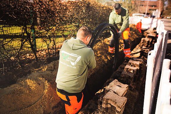
Open Excavations The best time to conduct the survey is while the pipeline is still visible. We document the actual as-built condition directly at the open excavation site, including depth and bedding. This eliminates the need for later excavation for inspection purposes.
Digital Network Documentation and GIS Integration
The collected data is used to create structured, digital network documentation that can be integrated into your GIS. Every object, along with its properties, is traceable and analyzable.
Data Import and Inventory Digitization
If your inventory exists only on paper or in old files, we digitize it and merge it with the new data. This creates a consistent database instead of a patchwork of disparate records.
Interfaces to Your Systems
We deliver the data in the formats your systems require and integrate it with your GIS or specialized software. The documentation is meant to be used in your operations—not left to gather dust in an export folder.


The Open Excavation Site Becomes a Digital As-Built Record
The crucial moment is when the pipeline is still exposed. What is recorded now will save others from having to reconstruct or expensively excavate it later. That’s why we closely integrate surveying with construction supervision: the as-built condition is documented while it’s still visible.
Step by step, this as-built survey becomes a digital as-built record. It shows not only where the pipeline runs, but also what material it’s made of, how deep it lies, and when it was built. For operation, maintenance, and future expansions, this is the foundation upon which everything else is built.


Your Benefits at a Glance
- Centimeter-precise, georeferenced data collection
- As-built documentation directly at the open pit
- Digital, GIS-compatible network documentation
- Digitization and consolidation of legacy data
- Data delivery in your preferred formats, integrated with your systems
- Surveying closely integrated with construction supervision

How Your Network Documentation Is Created
- Data Collection – Surveying and as-built documentation, preferably at the open excavation site.
- Structuring – Incorporating objects with their properties into a clean data model.
- Digitize – Import and consolidate existing legacy data.
- Integration – Integrating data into the GIS and managing interfaces.
- Delivery – A digital as-built file that your organization can use.

Give us a call
Your water network, digitally documented
Would you like to speak directly with our sales team? Our key account managers will be happy to assist you.

Contact Form
Your Direct Line to Us
Do you have any questions, requests, or suggestions regarding our services? Please feel free to use our contact form to get in touch with us.